
Island Range
Historic high grade production in the same rocks as NorthIsle’s North Island Copper-Gold Project and BHP’s historic Island Copper Mine

Defined priority targets: The Project covers several anomalies identified by previous exploration that were never tested, including: Happy John Extensions, Silver King & Copper Queen, Hecate Mountain and Handy Creek East.
Same rocks as NorthIsle’s North Island Copper-Gold Project and BHP’s historic Island Copper Mine: Located 25kms south of Port Alberni Island Ranges shares several geological characteristics these two nearby projects.

Located in a proven high grade copper production: The Island Range claims are contiguous with the historic Three Jays and Monitor copper producers. Three Jays historically produced at 7.50% copper, 0.97 g/t gold. Monitor historically produced at 9.08% copper, 0.05 g/t gold.
Work program commencing CY26: Imminently commencing next phase of work designed to build on the substantial body of historical exploration data, further refine tunderstanding of previously identified geochemical and geophysical anomalies, and assess the potential extensions of known mineralisation. Includes mapping, geochemical surveys and induced polarisation (IP) geophysics.
About the Island Range Copper Gold Project
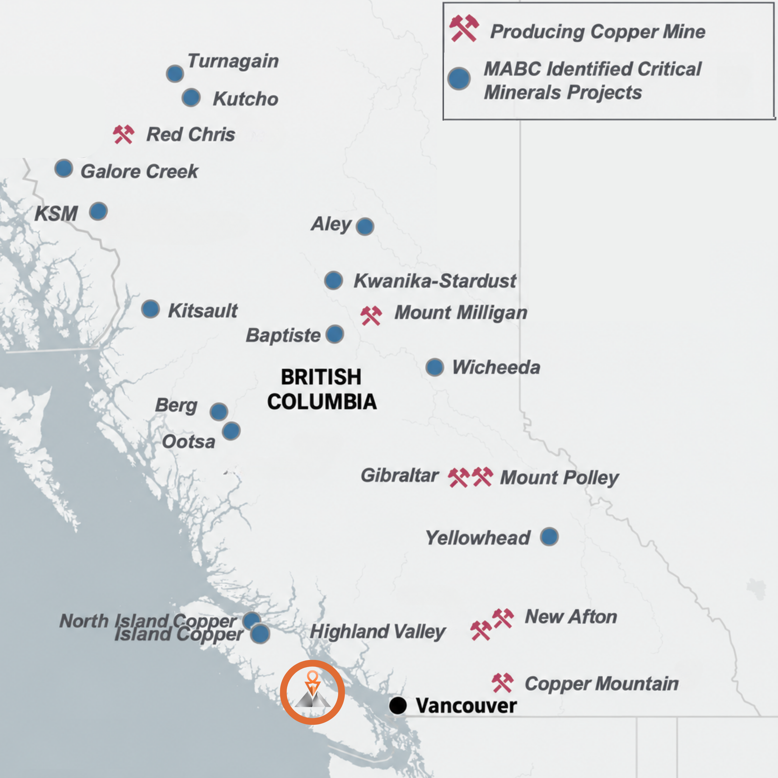
The Island Range Copper Gold Project comprises 7 contiguous mineral claims covering approximately 8,535 hectares on central Vancouver Island, British Columbia, approximately 25 kilometres south of Port Alberni. The Project benefits from established forestry road access, sheltered tidewater access via Alberni Inlet and proximity to existing services and infrastructure at Port Alberni.
Island Range hosts numerous high grade copper gold silver cobalt skarn occurrences, including Happy John, Silver King & Copper Queen and Sunshine, within a historically mineralised district that remains substantially underexplored by modern exploration and drilling. The Company is targeting a concealed copper gold porphyry system, supported by the presence of Jurassic Bonanza intrusive dykes, major structures, coherent multi element geochemical anomalies and significant magnetic responses. These features suggest that the surface skarns may represent the high level expression of a broader intrusive related mineralised system, with potential for both high grade skarn mineralisation and a larger concealed porphyry copper gold system.
Island Range shares several geological characteristics with NorthIsle Copper and Gold’s North Island Project and the former BHP operated Island Copper Mine. All three occur within Vancouver Island’s Wrangellia Terrane and Jurassic Bonanza magmatic arc, providing a relevant regional setting for the Company’s exploration concept. Jurassic Bonanza arc intrusive activity and associated porphyry and skarn style copper gold mineralisation are key features of these regional systems. From 1971 to 1995, Island Copper Mine produced approximately 2.71 billion pounds of copper, 1.13 million ounces of gold and 11.6 million ounces of silver. Earlier this year, NorthIsle updated the North Island Project’s indicated resource to 3.8 billion pounds of copper and 8.7 million ounces of gold, demonstrating the potential for substantial porphyry systems on Vancouver Island. (Baldys 2022; Ray 2013)
Island Range contains several of the geological ingredients that characterise systems such as NorthIsle’s North Island Project and BHP’s Island Copper Mine, yet is at a much earlier stage of exploration, with its potential concealed porphyry source still to be systematically tested.
The Project is contiguous with the historic Three Jays and Monitor copper mines, which reported average production grades of 7.50% copper and 0.97 g/t gold, and 9.08% copper and 0.05 g/t gold, respectively. Within Island Range, the Sunshine Prospect hosted artisanal production in 1916, with reported average grades of 17.38% copper and 43.6 g/t silver.
Island Range complements Osiris One’s existing Western Range Project, in which the Company acquired an 80% interest earlier this year and which it has subsequently expanded to cover further structures of interest.
CY26 Q4 Exploration Program
The Company will imminently commence a new exploration program across the more than 8,500 hectare project area. The next phase of work is designed to build on the substantial body of historical exploration data, further refine the Company’s understanding of previously identified geochemical and geophysical anomalies, and assess the potential extensions of known mineralised trends across the broader Project area.
The next phase will include:
High resolution drone mapping: A detailed drone based topographic and aerophotogrammetric survey. The program will generate high resolution digital terrain model and imagery dataset across the project area, providing an improved geological and structural base for integrating historical mining, surface geology, geochemistry and geophysical datasets.
Geochemical surveys: Systematic geochemical sampling will be undertaken across priority areas to further define previously identified copper gold anomalies and assess their continuity beyond the limits of historical sampling. The program will also investigate areas with limited previous coverage and assist in identifying broader geochemical trends that may indicate concealed or previously unrecognised mineralised systems.
Induced polarisation (IP) geophysics: Targeted IP surveying will be undertaken across priority geochemical and previously identified geophysical anomalies to better define the geometry and extent of potentially sulphide bearing zones at depth. The survey is intended to identify chargeability and resistivity responses associated with mineralised structures, skarn alteration and potential concealed intrusive related mineral systems, while providing greater definition of targets beneath areas of limited surface exposure.
Integrated geological interpretation and 3D modelling: Results from the new topographic, geochemical and IP programs will be integrated with previous exploration data, surface mapping and existing geophysical datasets. This work will support the development of an updated three dimensional geological and structural model of the project.
The Company expects the upcoming work program to generate multiple potential news catalysts, including completion and interpretation of geochemical sampling and completion and interpretation of the IP geophysics.